


Europe_East_880.3812.part3.rar
emeryt15 / NAWIGACJE / TOMTOM / Mapy 880 z 11.11.2011 / Europe_East_880_3812- 1.38 GB / Europe_East_880.3812.part3.rar
 Pobierz
Inne foldery z plikami do pobrania
-
Anglia i Irlandia -
Central_and_Eastern_Europe_1120_12089 -
Central_and_Eastern_Europe_1125_12189 -
Central_and_Eastern_Europe_1125_12195 -
Central_and_Eastern_Europe_1130_12309 -
Central_Europe_1120_12153 -
Central_Europe_1125_12198 -
Central_Europe_1130_12303 -
Central_Europe_East_1125_12189 -
Dodatki -
Eastern_Europe_1115_11998 -
Eastern_Europe_1125_12190 -
Eastern_Europe_1125_12198 -
Eastern_Europe_1130_12304 -
Europa jak na screni8e 1.77 GB -
Europa jak na screnie -
Europa jak na screnie 1.60 GB -
Europa jak na screnie 3.99 GB -
Europe TRUCK 1115.12010 -
Europe_1120_12089 -
Europe_1125_12198 -
Europe_Central_1120_12089 -
Europe_Central_1120_12153 -
Europe_Central_1125_12189 -
Europe_Central_1130_12303 -
Europe_Central_1130_12308 -
Europe_East_1120_12089 -
Europe_East_1130_12303 -
Europe_TRUCK_1110_11883 -
Europe_TRUCK_1120_12114 -
Europe_TRUCK_1125_12210 -
Europe_TRUCK_1125_12211 -
Garmin City Navigator Europe NTU 2024.20 -
Garmin City Navigator Europe NTU 2025.10 -
Map (All North) -
Map (All South) -
Mapsorce instalacyjna lock -
MapSource -
MAPY+1120 listopad 2023 -
MAPY+1125 luty 2024 -
MAPY+1130 Mj 2024 -
Marcin -
Poland_1120_12090 -
Poland_1125_12190 -
Poland_1125_12199 -
Poland_1130_12304 -
Polska -
RADARY -
Scandinavia_1120_12090 -
TOMEK
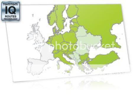
TomTom for PNA: Europe East U 880.3812 Multilingual | 1.38 GB
The eastern area of Europe - a map that includes all the forests, lakes and built area.
Features:
- Complete navigation 'from door to door' in the following countries: (99.9): Austria, Belgium, Vatican City, Hungary, Germany, Holland (Netherlands), Denmark, Greece, Italy, Liechtenstein, Lithuania, Luxembourg, Malta, Norway, Poland, San Marino, Slovakia, Slovenia, Finland, Sweden, Switzerland, Czech Republic, Estonia.
- Partial coverage of the following countries: Bulgaria (54/55 *), Latvia (62/63 *), Russia (37/45 *), Romania (14 *), Turkey (67/68 *), Ukraine (43 *) and Croatia (60 / 69 *, including major cities and the coast).
- For other Eastern European countries available network connecting roads, providing easy navigation throughout the region.
* - The different conflicting figures from official sources
Zone map of Eastern Europe for devices with internal memory of 2 GB. Neuproschennaya, Unicode supports ALG, IQ Route, HNR, ASR and Cspeech.
- Coverage of the roads, and about 10.3 million km / about 6.3 million miles
- Points of Interest (POI): 5,7 million POI
META:
; Europe_East_880_3812
11 C2 57 59 F5 6A 28 CF 35 E5 9A A2 23 2E D2 93 Europe_East-454.meta